Cart
36
Product
Products
$6,747.06
(empty)
-
 1 x C.E. Smith...$3.60
 -
 1 x Ancor...$6.51
 -
 1 x Sea-Dog...$12.53
 -
 1 x Paneltroni...$26.60
 -
 1 x Perko Fuel...$37.75
 -
 1 x Scanstrut...$366.75
 -
 1 x Raymarine...$923.07
 -
 1 x Perko...$75.83
 -
 1 x Xantrex...$773.71
 -
 1 x Humminbird...$37.36
 -
 1 x Pacer Red...$7.69
 -
 1 x Raymarine...$2,688.16
 -
 1 x Rule...$38.20
 -
 1 x Rule 3700...$304.75
 -
 1 x Swobbit...$9.32
 -
 1 x Perko...$82.65
 -
 1 x Rule...$201.35
 -
 1 x Johnson...$254.72
 -
 1 x Johnson...$181.41
 -
 1 x Ancor Lead...$3.72
 -
 1 x BEP Pro...$85.81
 -
 1 x Mustang...$19.99
 -
 1 x Garmin...$77.21
 -
 1 x Blue Sea...$1.72
 -
 1 x Paneltroni...$10.99
 -
 1 x C.E. Smith...$82.99
 -
 1 x Raymarine...$99.99
 -
 1 x Standard...$17.00
 -
 1 x Whitecap...$8.93
 -
 1 x Blue Sea...$5.69
 -
 1 x Blue Sea...$16.93
 -
 1 x Raymarine...$68.17
 -
 1 x Raymarine...$133.32
 -
 1 x Blue Sea...$5.76
 -
 1 x Davis...$54.17
 -
 1 x Raymarine...$22.71
No products
$23.99
Shipping
$6,771.05
Total
Product successfully added to your shopping cart
Quantity
Total
There are 36 items in your cart.
There is 1 item in your cart.
Total products
$6,747.06
Total shipping
$23.99
Total
$6,771.05
 View larger
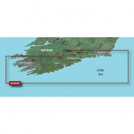
Garmin BlueChart g3 Vision HD - VEU482S - Wexford to Dingle Bay - microSD /SD
30794
30794
New product
Garmin BlueChart g3 Vision HD - VEU482S - Wexford to Dingle Bay - microSD /SD
More info
BlueChart® g3 Vision® HD - Wexford to Dingle Bay - microSD™/SD™
Coverage:
Detailed coverage of Southern Ireland from Wexford to Ventry. Also includes detailed coverage of Dungarvan, Cork, and Cahersiveen.
Premier Coastal Charts
- Industry-leading coverage, clarity and detail with updated coastal charts that feature integrated Garmin and Navionics® content
- Auto Guidance¹ technology quickly calculates a suggested route by using your desired depth and overhead clearance
- Includes Depth Range Shading for up to 10 depth ranges, enabling you to view your target depth at a glance
- Up to 1


